

You can find on this page the Tokyo trains map to print and to download in PDF. The Tokyo trains map presents the rail network and railway stations of the trains of Tokyo in Japan.
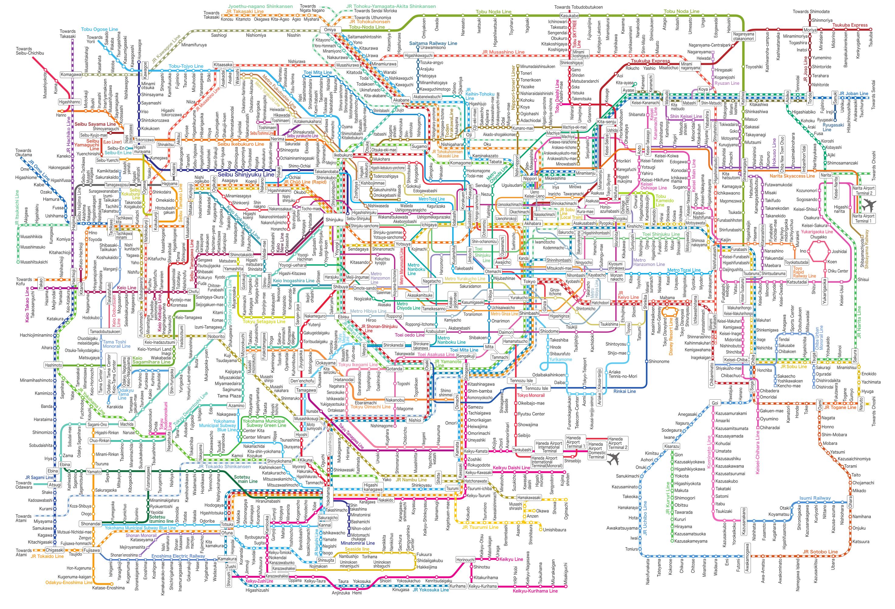
The Tokyo rails map shows all the railway stations and lines of Tokyo trains. This railway map of Tokyo will allow you to easily plan your route with the trains of Tokyo in Japan. The Tokyo rails map is downloadable in PDF, printable and free.
Rail is the primary mode of transport in Tokyo. Tokyo has one of the most extensive urban railway networks in the world, including surface lines. There are 30 operators, 102 passenger train lines serving Tokyo, and 19 more serving Greater Tokyo but not Tokyo proper, for a total of 121 serving the metropolitan area, not including some 12 cable cars as its mentioned in Tokyo rail map.
Rail and subway lines are highly integrated and dense; commuter trains from the suburbs continue directly into the subway network on many lines, often emerging on the other side of the city to serve another company surface commuter rail line. Shinjuku Station is the busiest train station in the world by passenger throughput (see Tokyo rail map).
There are 0.61 commuter rail stations in the Tokyo area per square mile (one for each 1.6 square miles as its shown in Tokyo rail map) of developed land area, though there are more in Osaka and Nagoya, combined with the high density connecting bus networks, Commuter rail ridership very dense, at 6 million per line mile annually, by the highest among automotive urban areas.