

You can find on this page the Tokyo buses map to print and to download in PDF. The Tokyo bus system map and the Tokyo trolley map present the network, stations and lines of the buses and trolley of Tokyo in Japan.
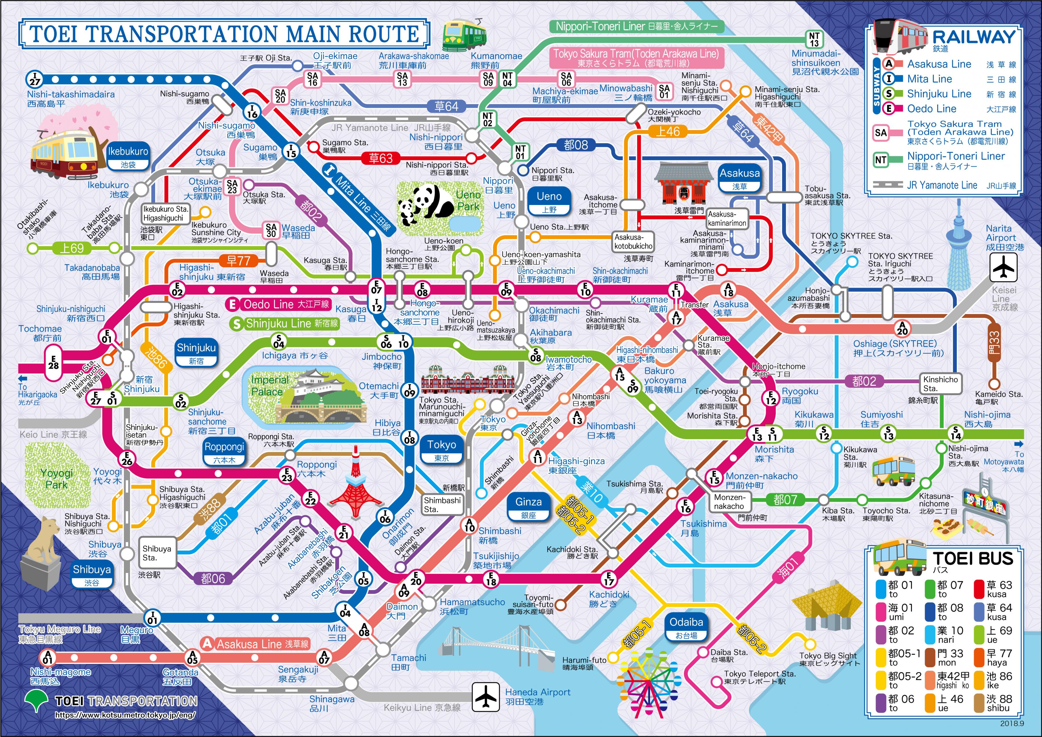
The Tokyo bus map shows all the stations and lines of the Tokyo bus system. This bus map of Tokyo will allow you to easily plan your routes in the buses of Tokyo in Japan. The Tokyo bus system map is downloadable in PDF, printable and free.
Public buses in Greater Tokyo usually serve a secondary role, feeding bus passengers to and from train stations. Exceptions are long distance bus services, buses in areas poorly served by rail (not many exist), and airport bus services for people with luggage (see Tokyo bus map). Toei runs over 1400 buses, many of them Non-Step for elderly passengers, and connect with Tokyo Toei and Tokyo metro subway stations.
Tokyo Metropolitan Bureau of Transportation operates Toei buses mainly within the 23 special wards while private bus companies (mostly the subsidiaries of the large train operators as its mentioned in Tokyo bus map) operate other bus routes, as do other city governments, such as Kawasaki City Bus, Yokohama City Bus, etc.
Toei buses have a fixed fare of 200 yen per ride (see Tokyo bus map), while most other companies charge according to distance. Some train operators offer combined bus/train tickets; special fares apply for children, seniors and the disabled. Some routes feature non-step buses with a kneeling function to assist mobility-impaired users.